Maps
TVA Maps
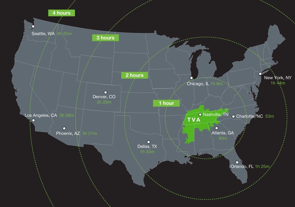
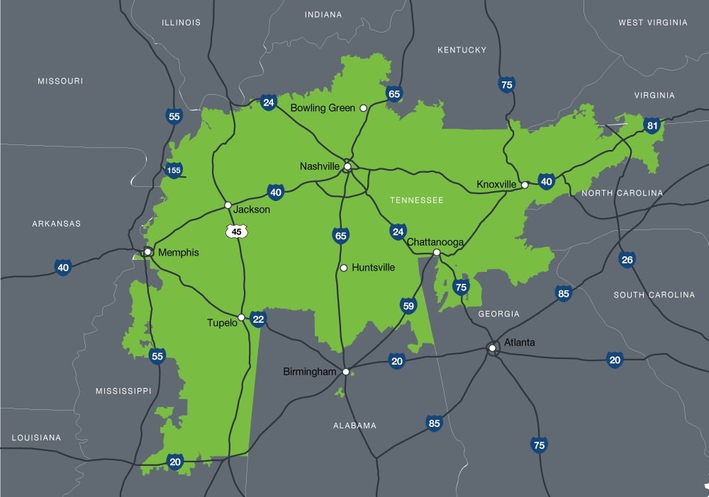
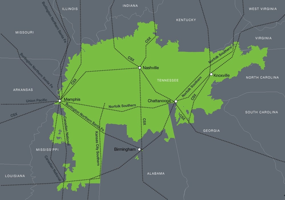
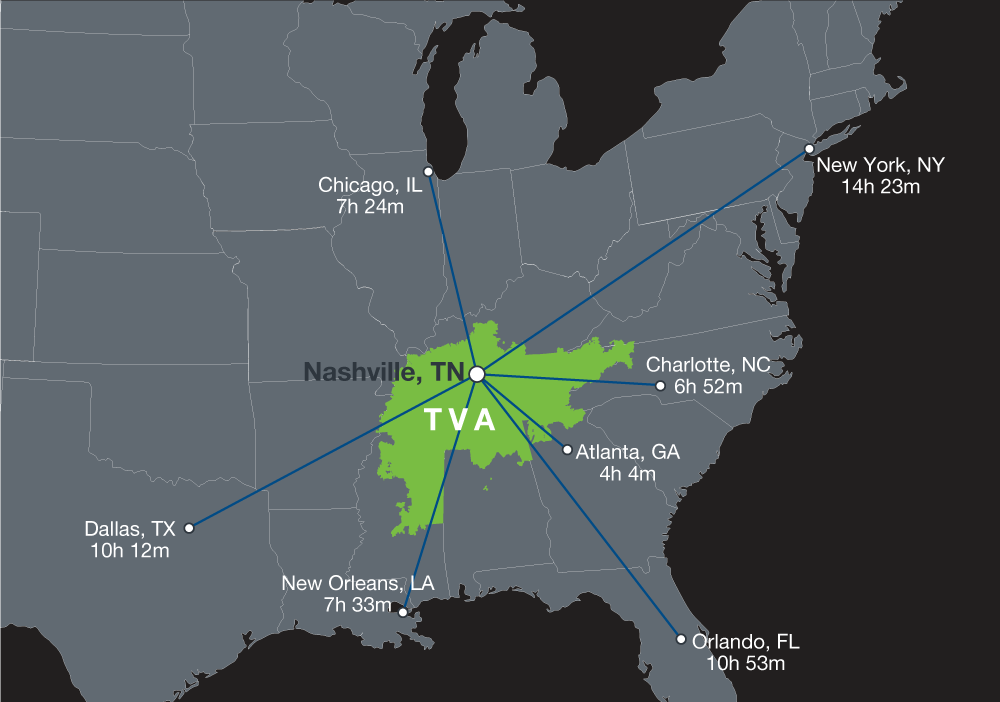
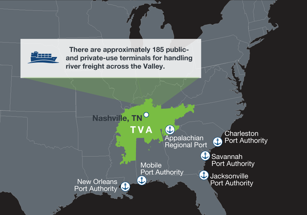
TVA maps are visual depictions of our region’s key assets and advantages. The five Tennessee Valley maps – flight times, interstates, rail lines, drive time, and ports – help tell the story of our region that’s centrally located and in close proximity to some of the nation’s biggest markets, connected via vast transportation networks, and situated in the southern U.S., the world’s third largest economy. All Tennessee Valley Authority maps are downloadable as .pdfs. Downloaded versions contain additional information.